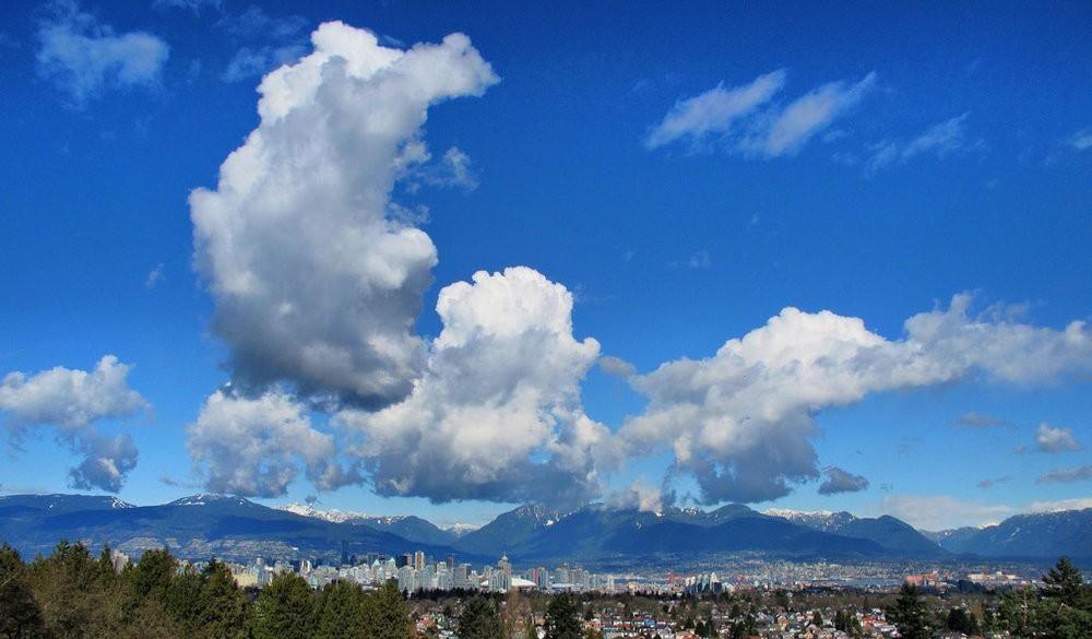
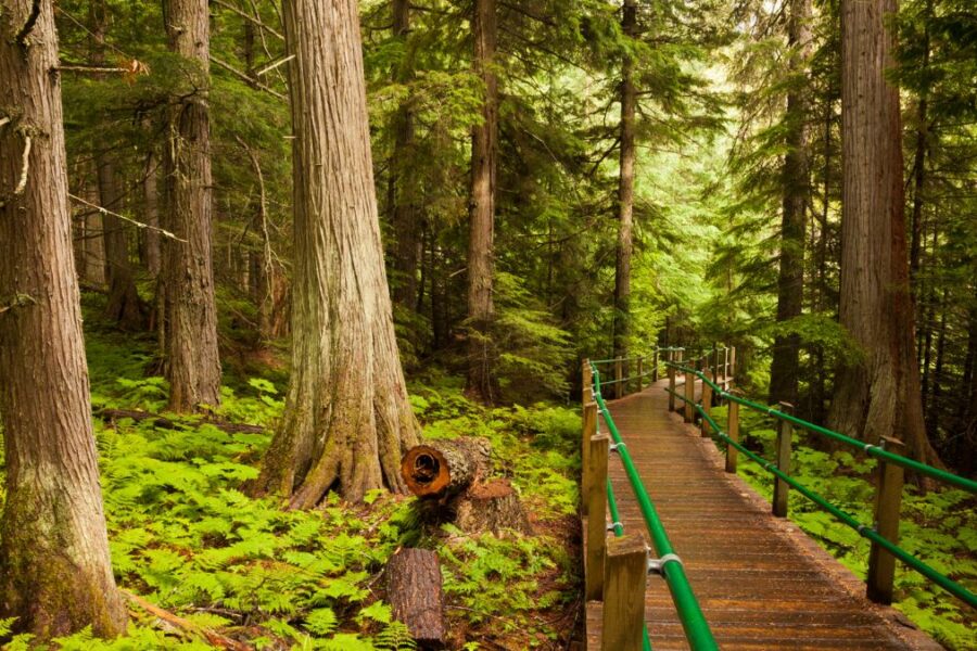
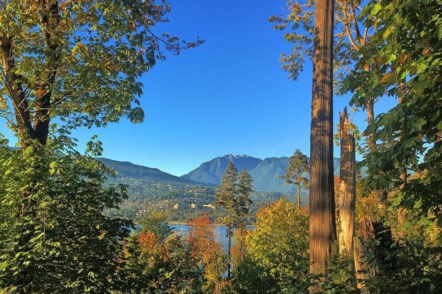
The Coast Mountains surrounding the city of Vancouver have an endless amount of hiking trails with some of the best alpine views found anywhere in the world.
The peak hiking season in Vancouver typically runs from May through to October and during this time most of these hiking trails are accessible. Some of these hiking trails can also be done in the winter with snowshoes and hiking boots with micro-spikes, depending on the conditions, such as Dog Mountain, Mount Seymour, Diez Vistas and the Stawamus Chief.
All of these 10 hikes offer some of the most amazing views with an extraordinary combination of mountains, rivers and ocean. They can all be completed on a day hike.
1. Dog Mountain
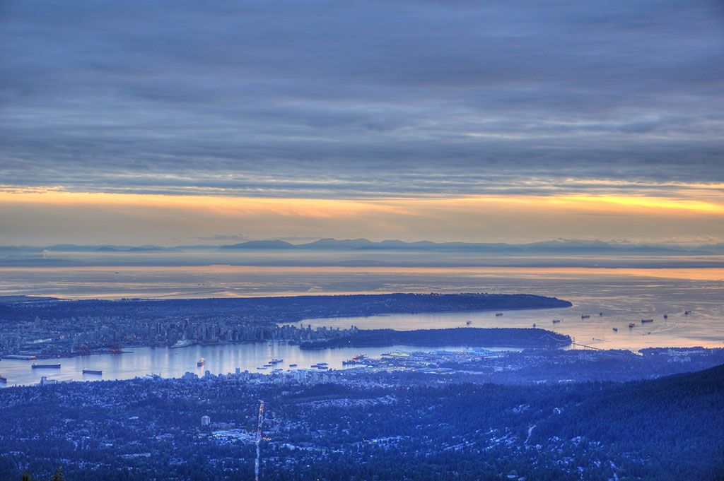
A surreal view of Vancouver’s natural harbour and the distant peaks of Vancouver Island as the sun sets.
Difficulty: Easy
Distance: 2 Hours
Length: 4.8 km
Elevation Gain: 157 m
The Dog Mountain bluffs offer the best-hike-to-view ratio in the Lower Mainland. I try to do this day hike at least once a month since it is a quick 30 minute drive from downtown and it only takes about 2 hours to complete the main hike. Plus, it is an easy hike in the snow.
The trailhead begins just past the Bear’s Paw lodge at the far end of the Mount Seymour parking lot. In the summer, the Dog Mountain bluffs and the other ridgelines higher up in Mount Seymour Provincial Park are excellent places to watch meteor showers and observe the northern lights.
This is an excellent afternoon or evening hiking tours because it offers absolutely awe-inspiring sunsets over the city of Vancouver and the mountaintops of Vancouver Island faraway in the distance.
2. Stawamus Chief
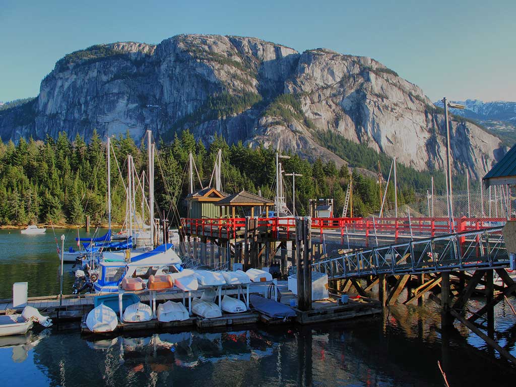
The mysterious crouching Stawamus Chief seen from the Squamish Marina.
Difficulty: Moderate
Distance: 4-5 Hours (to 2nd Peak)
Length: 5.8 km
Elevation Gain: 657 m
The Stawamus Chief, or “The Chief”, is the second largest free-standing granite outcropping in the world (after the Rock of Gibraltar). There are three domed summits you can hike to, all accessed by a trail that starts on the side of Stawamus Chief Provincial Park near Shannon Falls. The lowest dome takes about 3 hours and the highest dome takes 5 hours (all times are return trips).
The Chief in Squamish is also a world-famous rock climbing destination. Many professional climbers will spend the summer months living in the Stawamus Chief Provincial Park campground at the base.
There are also guided rock climbing tours available in the nearby town of Squamish to climb one of the many climbing routes on the front face.
3. St. Mark’s Summit
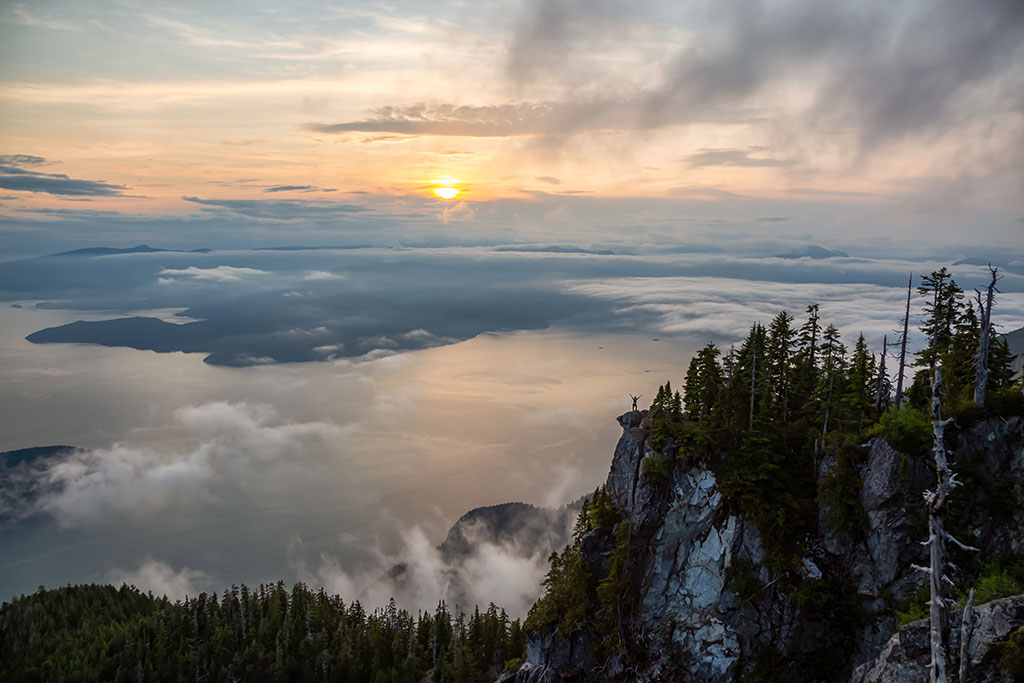
A spectacular view over of Howe Sound as the mountains of the Sunshine Coast fade into the clouds in the distance.
Difficulty: Moderate
Distance: 5-6 Hours
Length: 10 km
Elevation Gain: 570 m
St Mark’s Summit is an intermediate day hike that starts by the Cypress Mountain day lodge. It winds 11 km along the Howe Sound Crest Trail and offers spectacular views of Bowen Island, Gambier Island and the mountains of Vancouver Island in the distance.
If you’re really ambitious and you want to hike the entire Howe Crest Sound Trail it takes 1-2 days to hike the full 32 kilometres and you can reserve stays at campsites and alpine huts in advance.
There are many other mountains along the trail that have much better views like the Binkert Lions, Unnecessary Mountain and Mount Harvey, but St. Mark’s Summit is the easiest hike. The other peaks can be difficult to reach until mid-to-late summer when the snow has melted.
4. Mount Cheam
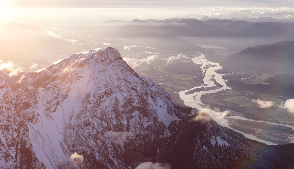
The view from Mount Cheam of the Fraser River Valley.
Difficulty: Hard
Distance: 10-12 Hours
Length: 29.6 km
Elevation Gain: 1,413 m
Mount Cheam is the highest peak in the Fraser Valley but also one of the easiest climbs thanks to a logging road that gets you within a one-hour hike of the summit. However, if you don’t have a 4×4 vehicle you’ll need to book a guided hiking tour to get to the top on the backcountry forest service road.
Alternatively, you can hike up from the Chipmunk Creek and it takes about 10-12 hours. It is generally accessible by car in the summer but keep in mind the road is snowed-in for most of the year so the best time to go is between July and October.
From the top of Mount Cheam you have sweeping views of the Fraser River winding its way toward the Pacific Ocean just south of the city of Vancouver. An easier alternative below Mount Cheam is to visit Bridal Veil Falls and Jones Lake.
Mount Baker Recreation Area
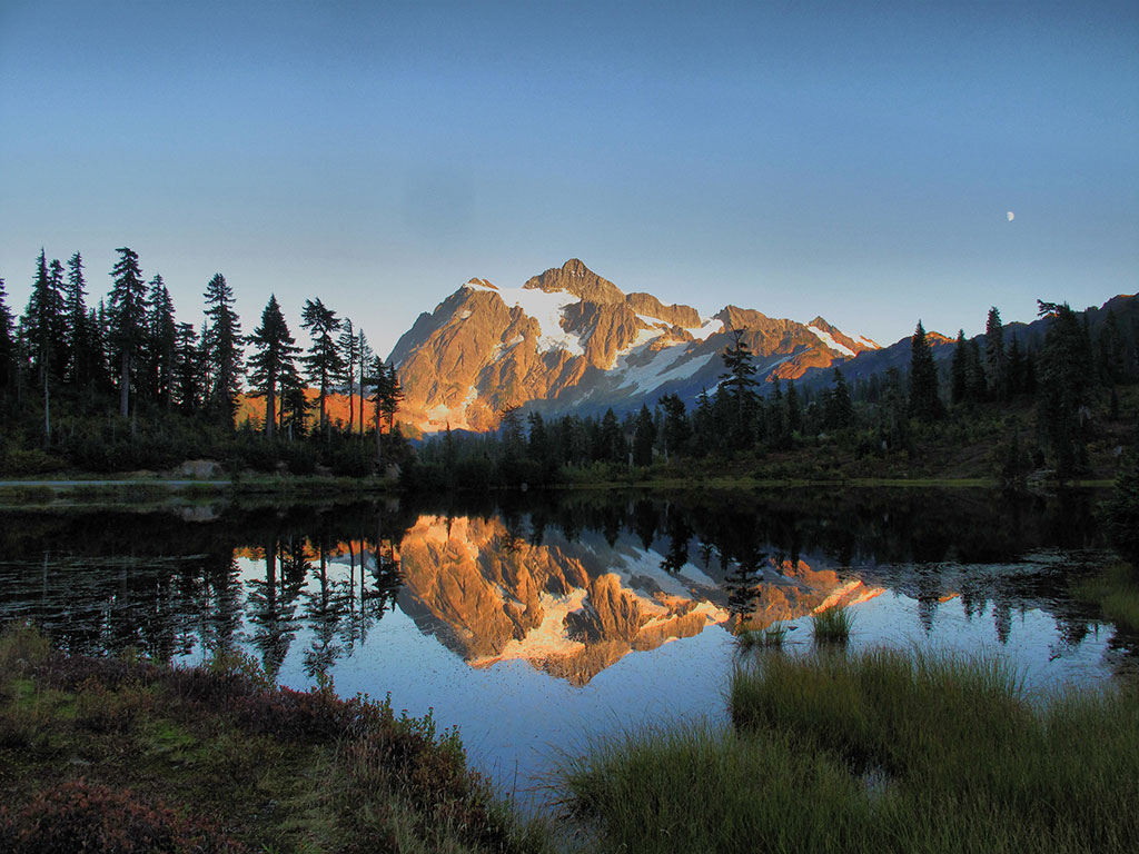
The late summer view of Mount Shuksan reflected in the calm waters of Picture Lake.
Difficulty: Hard
Distance: 8-12 Hours (to summit Mount Baker)
Only a 2-hour drive and a quick border crossing at Sumas from Vancouver, Mount Baker Recreational Area offers amazing high alpine hiking right from the parking lot at 4,200 feet. In the summer and fall you can drive up to Artist’s Point and from there you can access many excellent hikes that can be completed in a few hours.
The mountain scenery in this alpine area is simply outstanding. If you want a more challenging hike you can attempt to trek Mount Shuksan pictured above or make the ascent of the 10,781-foot volcano Mount Baker which can be done with a local trekking company in a single day if you start at 3 am (from the top of both mountains you can see Vancouver on a clear day).
In the winter months, Mount Baker Ski Resort offers winter trekking and some of the best powder in the world. The resort actually holds the world record for the most snow at a ski area in a single season. The record-setting snowfall in the 1998-99 season was 1,140 inches (95 feet)!
There are some hiking tour companies that offer tours from Vancouver to climb Mount Baker but generally it’s easier and cheap to do from Bellingham or Seattle in the United States.
6. Garibaldi Lake
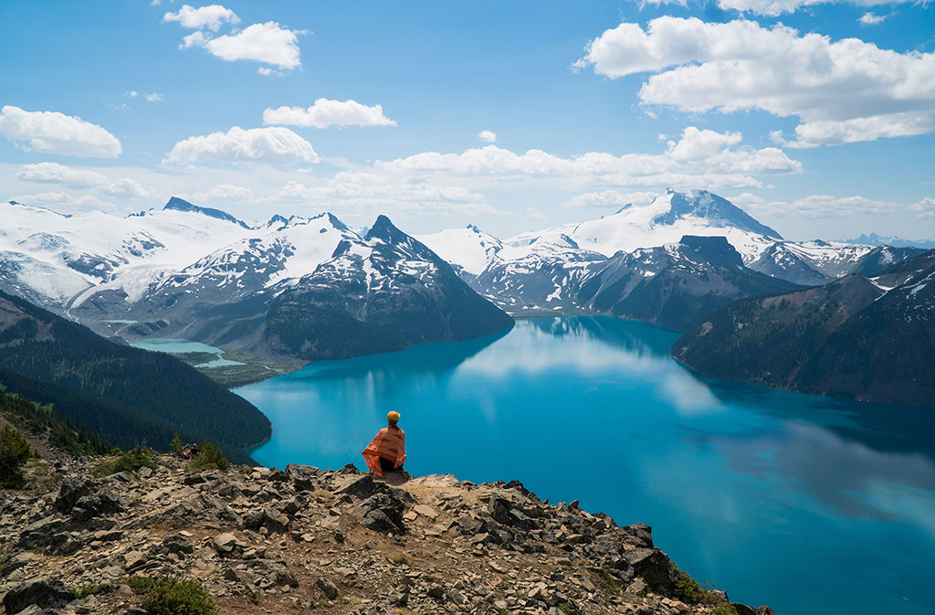
The view of Garibaldi Lake‘s aqua-blue waters and the glaciers of Mount Garibaldi from Panorama Ridge.
Difficulty: Moderate
Distance: 6-10 Hours
Length: 18.2 km
Elevation Gain: 979 m
The 3-hour hike up to Garibaldi Lake is a tedious trek along seemingly endless switchbacks. But once you arrive at Garibaldi Lake you will be blown away by just how insanely beautiful this glacial lake is.
While it can be done in a day, it is better to spend a few days at the beautiful campground along the southern shore. Book ahead at the Garibaldi Lake Provincial Park campground.
From the campground, you can hike to Panorama Ridge, the Battleship Islands and Cheakamus Lake. The wildflowers in the Black Tusk meadows are absolutely amazing in mid-Summer and from there, it’s a short but challenging hike to the top of Black Tusk where you can see Whistler and the Pacific Ocean from the same peak.
Another great hiking tour in Garibaldi Provincial Park to consider is the Elfin Lakes on the other side of Mount Garibaldi.
7. Diez Vistas
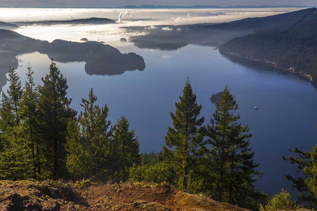
A wonderful view of Indian Arm and the Vancouver city skyline in the morning fog.
Difficulty: Moderate
Distance: 4-6 Hours
Length: 12.7 km
Elevation Gain: 632 m
The Diez Vistas trail is a nice 4-6 hour hike along the ridgelines above Indian Arm and Bunsen Lake in Belcarra Regional Park.
On the way back down, it is worth stopping at Buntzen Lake or drive 5 minutes to the much warmer Sasamat Lake (also called White Pine Beach) for a swim.
The trailhead begins at the south end of Buntzen Lake. From the main beach, you should walk to your left and follow the marshlands to a boardwalk. Walk across the boardwalk and you will see the marked ascent begins on the other side.
8. Crown Mountain
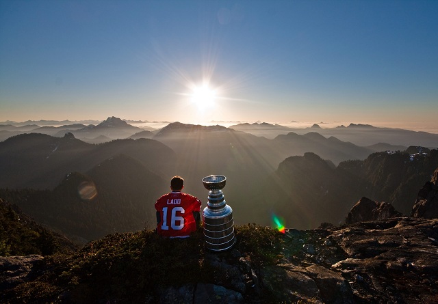
When I saw this photo it just blew me away. Local boy and two-time Stanley Cup champion Andrew Ladd fulfilling his dream to watch the sunrise on Crown Mountain with the Stanley Cup. (Photo by Mark L. Johnson)
Difficulty: Hard
Distance: 4-6 Hours (save 2 hours by taking the Grouse Mountain Skyride)
Length: 9.2 km
Elevation Gain: 866 m
Crown Mountain is one of the most distinctive peaks visible from downtown Vancouver. You have to take the Grouse Mountain skyride to access the trailhead although it’s possible to take the knee-crushing Grouse Grind or the more peaceful BCMC trail.
The Crown Mountain trail starts just beyond the Grizzly Bear refuge on Grouse Mountain and it takes about 5 hours to the peak and back. The pyramid-like peak in the top left of the picture above is Cathedral Mountain, the highest visible peak from Vancouver in the North Shore Mountains. Brunswick Mountain, the highest peak in the North Shore Mountains at 1,788 m (5,866 ft) is accessed from the Howe Sound Crest Trail.
I also highly recommended hiking to Goat Mountain, the peak to the right of Crown Mountain. It is much easier and only takes about 4 hours to the summit and back.
9. Mount Seymour
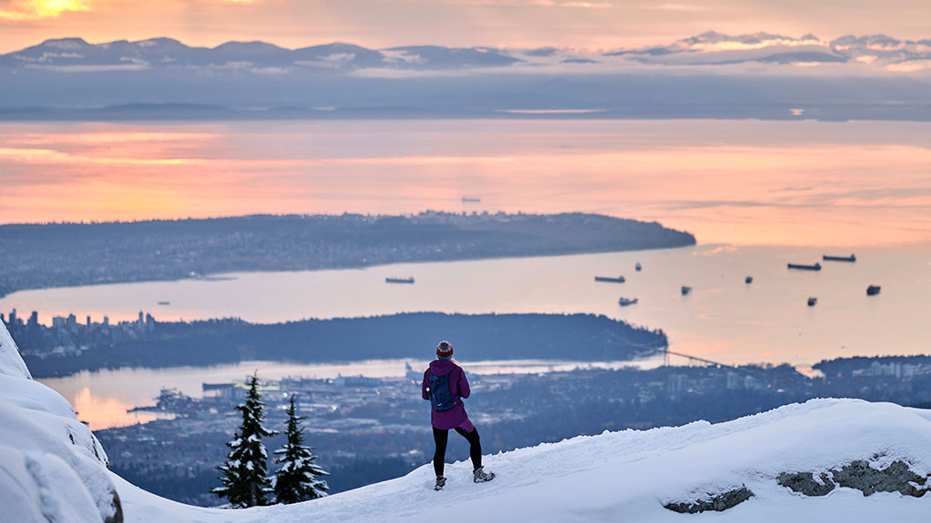
The view of the city of Vancouver, the Georgia Straight and Vancouver Island from the Mount Seymour alpine in the winter.
Difficulty: Moderate
Distance: 3-5 Hours
Length: 7.7 km
Elevation Gain: 553 m
Mount Seymour is a 5-hour hike from the Mount Seymour Ski Resort parking lot. The trail follows the edge of Mount Seymour’s ski runs and then you climb the three “pumps”, which are large dome-like mountaintops. The third “pump” is the summit of Mount Seymour. The views of Vancouver and the Lower Mainland on the way down will take your breath away.
I find it is the most fun to do this hike in the winter when you can ski, slide or snowboard back down. There are usually lots of interesting and friendly people in the Seymour Backcountry hiking around and building jumps in the winter.
If you attain a backcountry camping permit at the Mount Seymour Provincial Park office you can also camp in the park.
10. The Binkert Lions

The distinctive twin Lions are a geographical landmark that can been seen across the Lower Mainland.
Difficulty: Hard
Distance: 7-8 Hours
Length: 14.6 km
Elevation Gain: 1,462 m
The Lions Gate Bridge is named in honour of these distinctive twin peaks and they are a famous natural landmark visible throughout the Lower Mainland.
The best way to reach these peaks is an 8-hour hike along the Binkert Trail (named after Paul Binkert of the BC Mountaineering Club) from the village of Lions Bay. You can also hike to the Lions from the Howe Sound Crest Trail that begins in Cypress Provincial Park.
Overall, this is probably the hardest hike on the list and you can only summit the slightly higher 1,646 m (5,400 ft) West Lion (on the left in the picture) because the East Lion is protected in the Vancouver watershed. It is recommended to have rock climbing equipment and ropes to summit the West Lion unless you are a highly experienced hiker.
- 10 Best Peru Hiking Tours And Multi-Day Treks In The Andes - April 19, 2025
- 10 Best Banff Hiking Tours In The Canadian Rockies - April 19, 2025
- 10 Best Vancouver Hiking Tours In The BC Coast Mountains - April 19, 2025


