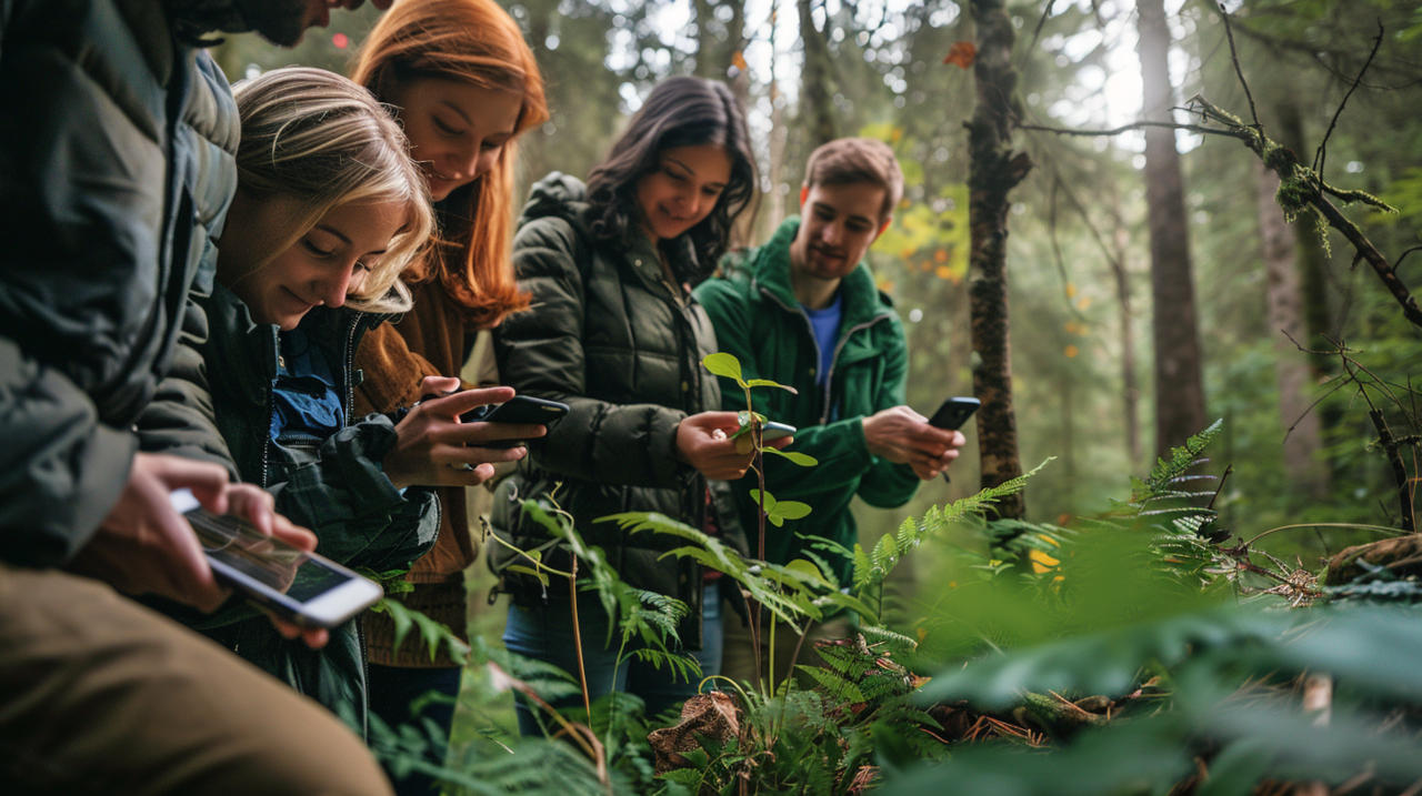
Getting outdoors is so good for your body and mind it should be called a necessity. The air is clearer, you work your muscles, you can experience awe and get into a flow state. There’s also so much to learn.
But don’t be too quick to call the smartphone a distraction from that world. Used in the right way, it can help you tune into nature with increasing clarity and understanding.
By deliberately choosing the apps you use, and when you use them, your phone can make your outdoor pursuits more engaging and thoughtful. It can help you understand what’s around you, from the wildlife to the terrain and the stars above.
To that end, below are 15 apps for both iPhone and Android that will inspire flow experiences and provide ample learning opportunities during your outdoor explorations.
1. Seek: Identify flora, fauna and fungi instantly with your camera
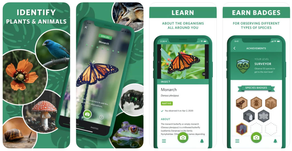
AI is developing its eyes at a rapid clip. Different versions are been built to recognise everything from the emotion in certain facial expressions to which supermarket shelves need restocking. As you’ll see throughout the list, identifying objects in the natural world is now within its grasp.
Case in point: Seek. When you open the Seek app and point your camera towards different wildlife, plants, and fungi, it’ll know what you’re looking at.
The app draws on data stored in iNaturalist (more on that below). At the time of releasing version 2.0 in 2019, this dataset included 15,798 species and 12,524 taxonomic groups.
Furthermore, when you go about identifying different species, you earn badges to unlock more information about those species. There are even monthly competitions you can participate in.
So, you get to learn more about the ecosystems and biodiversity around you, with the gamification helping increase engagement and promote a flow state.
Adding to that, Seek is free for both iOS and Android.
2. iNaturalist: Become a citizen scientist and catalogue your discoveries
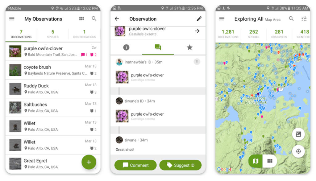
The data from iNaturalist powers the recognition capabilities of the Seek app above. Here is where you can help contribute to that data, as well as engage with the community about what you and others have found.
This is citizen science—getting the general public to help with scientific research and discovery. You and others can help map biodiversity around the world, while scientists can use the data provided to support their research.
In iNaturalist, you can call on the help of a large community of other nature enthusiasts, experts, and scientists to help identify and talk about different life forms. As of this writing, users have made over 180 million observations of over 470,000 species.
There are many projects where you can contribute your specific observations, from fluorescent organisms to bugs in flight, or you can create your own. There are also challenges to be had, like the City Nature Challenge, a ‘bio blitz’ aimed at surveying plants and animals in urban areas.
iNaturalist is free and can be accessed through the web or an app on both Android and iOS.
3. Merlin: Learn to identify bird songs when you’re outside
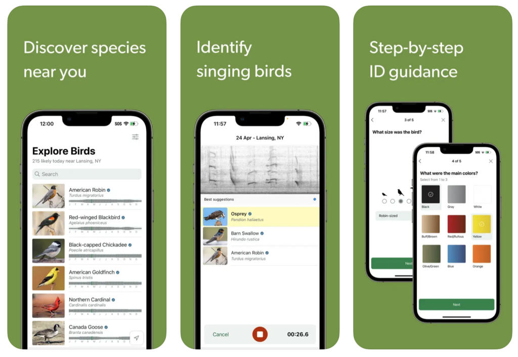
This app from Cornell Labs will take your bird-watching abilities to the next level. There are several different ways you can use Merlin to identify the birds in your vicinity:
- You can identify them by answering a few questions about the bird, such as size and colour.
- You can use the Photo ID feature, which uses machine learning to match birds on your camera roll with a database in Macaulay Library through the eBird platform (more on that below).
- You can use Sound ID, which will match any sound recording of a bird song with the bird doing the singing. It’s like Shazam for birds.
Both Sound ID and Photo ID work offline which is a plus when you’re out in the woods with no connection. However, Sound ID is largely limited to birds in the US, Canada, and Europe, with some from Central and South America, and India—though this still includes 1,054 species.
You can also store all your findings in a scrapbook for help keeping track, and check out lists of local birds to motivate your exploration.
Merlin is free to use and available on both Android and Apple devices.
4. eBird: Track your bird sightings in bird lists
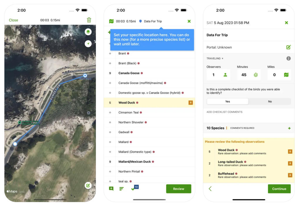
The Merlin app above is powered by the community on eBird, an online database of birds that’s been collected by people all over the world.
Like iNaturalist, eBird is a citizen science endeavour, giving you and others a chance to contribute to the mapping of global bird species. The research can then help inform decisions about habitat protection, species management, and other important conservation work.
You can photograph and record the sounds of different birds, and upload and tag them, which will help improve the machine recognition capabilities of the Merlin app.
In addition to tracking the birds you find, the app can help track the path you take so you can see how far you’ve walked, and you can download area maps for offline use.
You’ll also find information on worldwide hotspots and advice on yearly changes in bird sightings. And if you really want to level up your birdwatching skills, Cornell offers a range of online courses covering everything from bird behaviour to photography.
The eBird app is free for iOS and Android devices, the online courses from Cornell range from $30 to $230—there is one free course on learning how to use the eBird tools.
5. Geocaching: Go on wild treasure hunts to find hidden geocaches
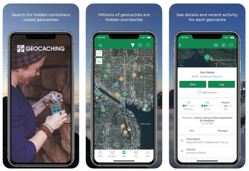
Geocaching takes one of those activities we all loved as children—treasure hunting—and makes it a global challenge appropriate for anyone with a love for exploration and a keen eye.
The idea is fairly simple: open the app and scan the map for a treasure (a geocache) near you, set it as your destination, and then go hunting for it. Some will be easier to find than others, as they can be stored in obvious containers or hidden where you least expect it.
When you find it, you sign the logbook within and place it back where you found it, for the next treasure hunters. Log the finding on the app to keep track of all the geocaches you’ve found.
Some containers will have items called Trackables. These are supposed to be traded—you take one and leave another. What’s fun about Trackables is that they have ‘goals’, which people are supposed to try and move them closer to.
You can register that you’ve found the trackable through the app, which will also tell you where its goal is. You go and place it in another geocache that’s a bit closer to that goal, and so does the next person, and so on.
Geocaching is available on both iOS and Android devices or through the web. The free version has limited caches while a premium subscription ($6.99 per month or $39.99 annually) unlocks them all, and has some additional features like downloading trail maps and tracking personal statistics.
6. Star Walk 2: Understand the night sky and the constellations
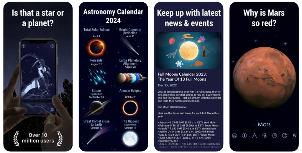
Star Walk 2 is for those who prefer to turn their gaze beyond the confines of Earth. It can point out all the major star systems viewable from your location, and suggest the best times to view certain astronomical events.
Using your phone’s GPS and gyroscope, you can point the app and see what’s (way) out there in that precise direction. It’s an immersive, augmented reality that doesn’t require a bulky headset.
There’s also a lot of information and 3D models of the constellations, stars, planets, satellites, asteroids, comets, and other space-faring objects you find.
You can even sign up for updates and alerts about upcoming celestial events, so you can make sure you don’t miss out on those rare and unique experiences.
There’s a free version of Star Walk 2 with ads for iOS and Android, or you can upgrade to the paid version for $1 a month. There are also in-app purchases for extra content that are $1 each.
7. NatureDose: Track your regular doses of prescription nature
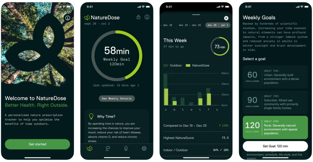
It’s no secret that nature is good for our health. The outdoors can restore both body and mind, and society broadly benefits by having green spaces for the population to enjoy. NatureDose helps ensure you’re reaping these rewards by tracking and encouraging your immersion in nature.
You can set your desired target for time spent outdoors, track how much time you’ve spent both indoors and out, and get daily and weekly breakdowns and comparisons with helpful tips and suggestions along the way.
An interesting feature of NatureDose is its NatureScore, which attempts to quantify the natural qualities of different neighbourhoods. It combines data from a range of sources, including satellite infrared vegetation measurements, computer vision of street views, and land classification databases
This all allows you to make more informed decisions on where to spend your time, whether it’s just for a walk, for a holiday, or where to live.
NatureDose is free for both iOS and Android devices.
8. AllTrails: Find local hiking trails that are top-rated for beauty and views
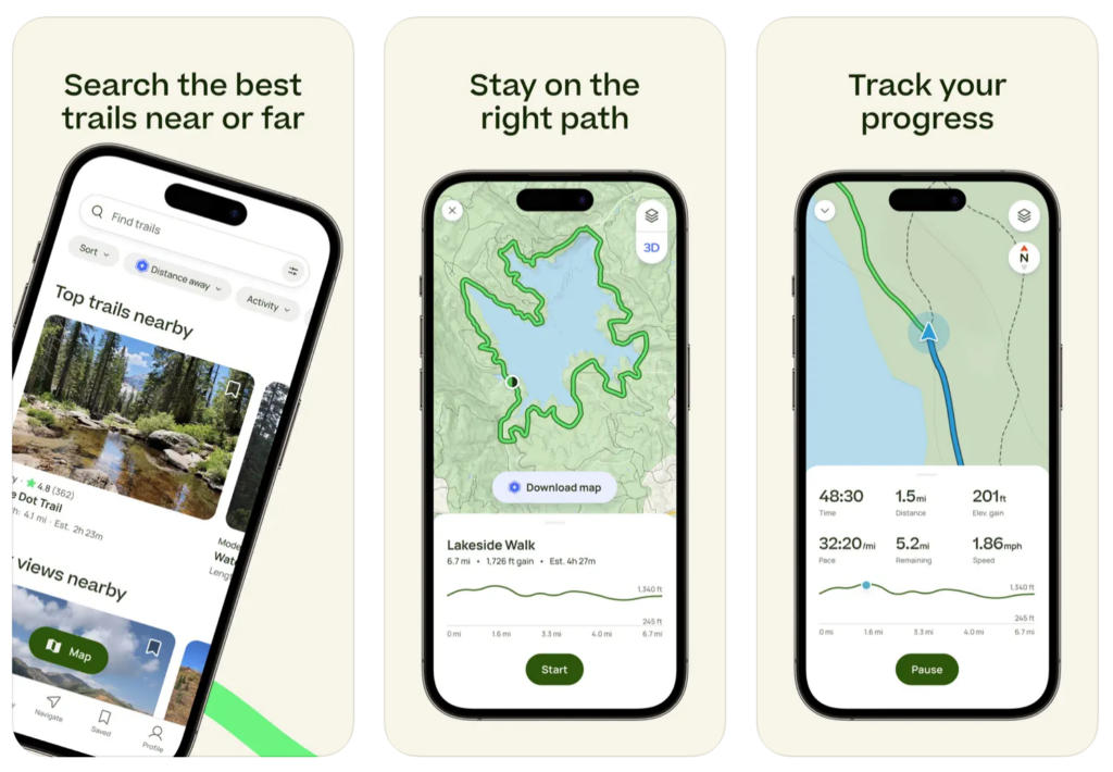
Google Maps can only take you so far. When it comes to going off the beaten path, into the wilderness, over the mountains and around the lakes, your best bet for directions is AllTrails.
Inside the app, you’ll find over 400,000 walks around the world, inside urban areas or out in the middle of nowhere.
There’s an active community too, so you’ll find each path has been given a rating by numerous other hikers, directions for help with any more obscure sections of tracks, and photos that others have collected along the way.
Available for both Android and iOS, the free version of the app will let you search through the trails, save them to lists, and use your phone’s GPS to help you navigate your way around. For the price of nothing, it’s a very good app.
AllTrails+, the paid version which you can get for $36 per year, lets you download maps for offline use, get alerts about wrong turns, share your route with others such as an emergency contact, and access guides and other map details.
9. Shroomify: Identify mushrooms growing in your local ecosystem
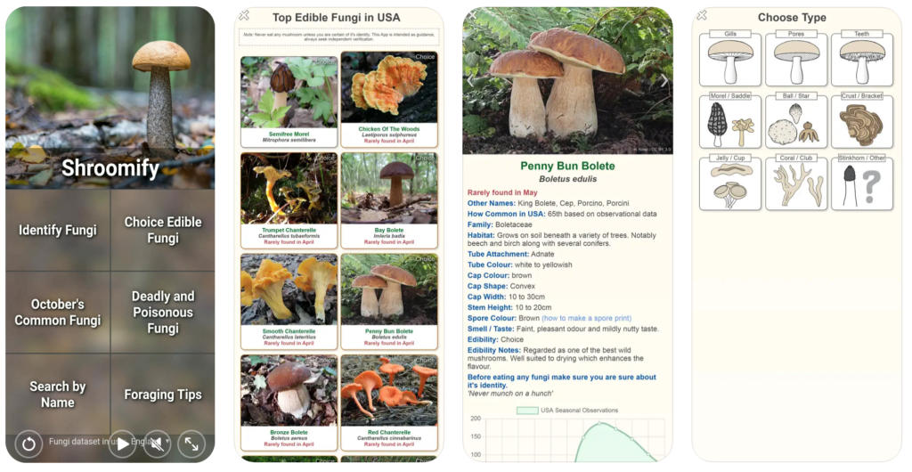
If you’ve been out walking and stumbled across some strange or fascinating-looking mushroom, wondered what its name is, and contemplated how it would taste with a risotto, Shroomify will come in handy.
Identifying mushrooms can be a risky business. Some of them are of course edible, some are hallucinogenic, others can be lethal. Recognition therefore needs to be accurate, and even Shroomify warns you that it is intended only as a guide: “Never munch on a hunch,” they say.
To identify the mushroom in question, Shroomify will enquire about several of its features: the type (gills? teeth? ball? etc), the colour, the cap shape and width, and the attachment. You need to look closely, but the result is a higher likelihood of getting the right match.
From there you can get more info—how common it is, where and when it grows, whether it’s edible, and more.
If you don’t have a ‘shroom to identify but want to brush up on your foraging knowledge, you’ll find sections on foraging tips, the common types you’ll find for the time of year you’re in, and lists of edible and deadly mushrooms (with friendly names like ‘funeral bell’ and ‘destroying angel’).
The free version of Shroomify (on both iOS and Android) will only display one photo with each of the mushrooms listed, to see more you can get the paid version for $3.
10. iTrack: Track wildlife and learn to identify animal tracks
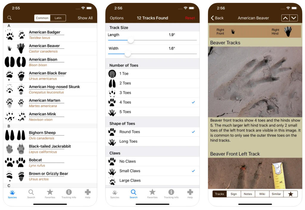
The nice thing about hunting mushrooms is that they don’t run away, the same can’t be said of legged creatures. To track them, you can get the help of iTrack, which helps you match footprints with the corresponding animal.
The app will ask you to describe the important features—the length and width, shape, presence of claws, number of toes, and so forth. All of which offer clues about who has been roaming in this neck of the woods.
It will then look through its database of animals to find the best fit, and provide additional photos to ensure that the potential match also passes the eye test.
There are two iTrack apps for different regions: North America, with data on 71 local animals; and South Africa, with another 61 animals. These numbers are of course likely to grow over time.
For both Android and iOS users, there’s a free version of the North American iTrack (limited to 8 species), while the pro versions for North America and South Africa cost $15 each.
There is also an iTrack Basic version for iOS only, at $5, which is a middle way between free and pro versions, containing 40 North American animals.
11. Gaia GPS: Offline maps for exploring wild places off-the-beaten-path
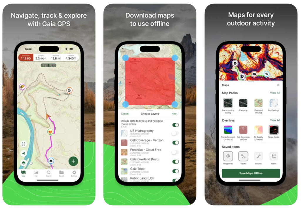
Similar to AllTrails, Gaia GPS gives you tools to escape urban environments and explore wild terrain.
In this case, you can download from an expert-curated selection of maps and trails, create your own paths with distance and elevation calculations, and get detailed weather forecasts and terrain information to ensure you know what to expect.
The maps on Gaia are reminiscent of the old paper variety (remember them?)—markings for elevation, campsites, tracks and other features are easy to find and make sense of. It’s aesthetically pleasing, and if you’re so inclined there’s a feature for printing the maps, good for both the trek and then for the wall.
There’s a free version on both Apple and Android, with basic maps and the ability to create tracks and record your activities. There’s also a Premium version with all maps unlocked, offline use, and weather and terrain details, for $5 per month on a yearly subscription.
Then there’s a Premium option for $7.50 per month, with the addition of content from Outside, a media company focused on all things outdoors—you’ll get access to courses with Outside Learn, films and live TV on Outside Watch, and access to 15 publications in the Outside Network.
12. Picture Insect: Identify insects, bugs and spiders in your local ecosystem
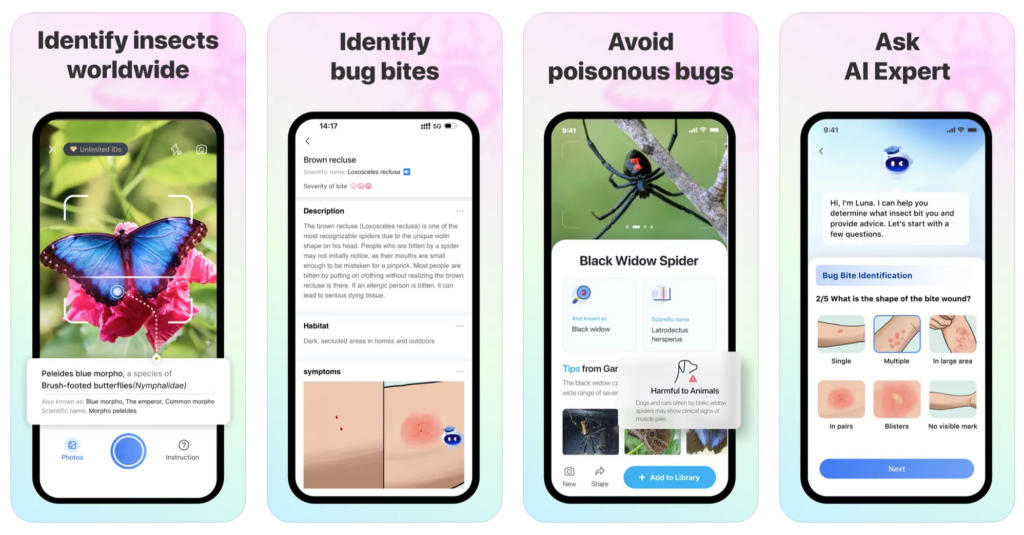
While they might not be as visible as plants and animals, underfoot and overhead there is a vast array of bugs and insects, flying, crawling, climbing, burrowing, slithering, and weaving.
Some might prompt you to exclaim ‘gross!’, others might inspire your curiosity. If you have more of the latter response, you can use Picture Insect to learn more about these little lifeforms.
The app relies on AI recognition, and is capable of identifying over 4,000 species. This is coupled with an encyclopedia and high-definition images.
This is all the more helpful when you have a pest you need to get rid of, or you’ve been bitten and are wondering how concerned you should be—getting the right information in a timely manner can help alleviate those concerns with less trouble, or prevent them in the first place.
Available for both iOS and Android, there’s a 7-day trial, and then the yearly plan for $30.
13. PictureThis: Identify house plants and wild plants with your camera
If getting out into nature is so great for our health, it’s not that surprising that bringing some of nature into the home and garden also has its benefits.
House plants do, however, require some extra care. They can be picky, requiring particular temperatures, light levels, and soil composition, and they can be susceptible to different pests and diseases.
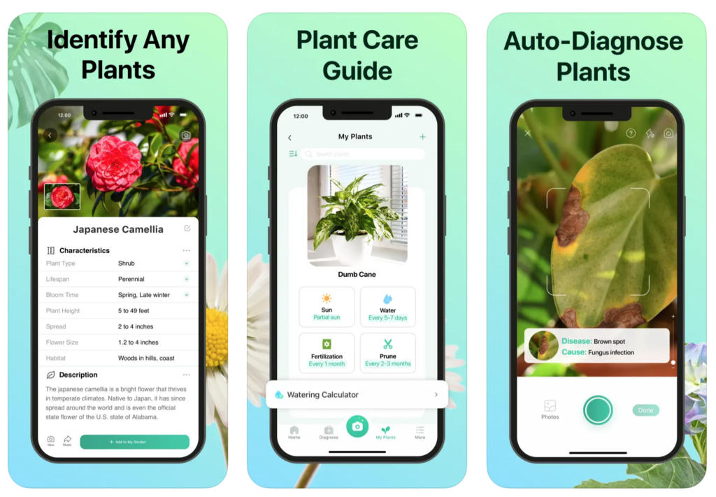
With PictureThis, you can use their AI recognition to figure out what plant you’re looking at, with the app able to identify over 17,000 plant varieties, and then get information on the type of care it requires.
You can also get AI-powered diagnoses of plant problems, and recommendations on places in your home with the best light. If you still need more help, the app has a function for messaging with experts on plant care.
For both iOS and Android, the free version is great for identification, but for AI diagnoses and extra information you’ll need the Premium version—there’s a 7-day trial, then $40 per year.
14. PeakFinder: Identify the names and heights of peaks in the mountains
Some mountains are iconic, inspiring awe from any angle—think of the Matterhorn, Everest, and Monte Fitz Roy. Others are a little more reserved, unknown by most, yet still worthy of having a name, offering a challenge, and providing a view.
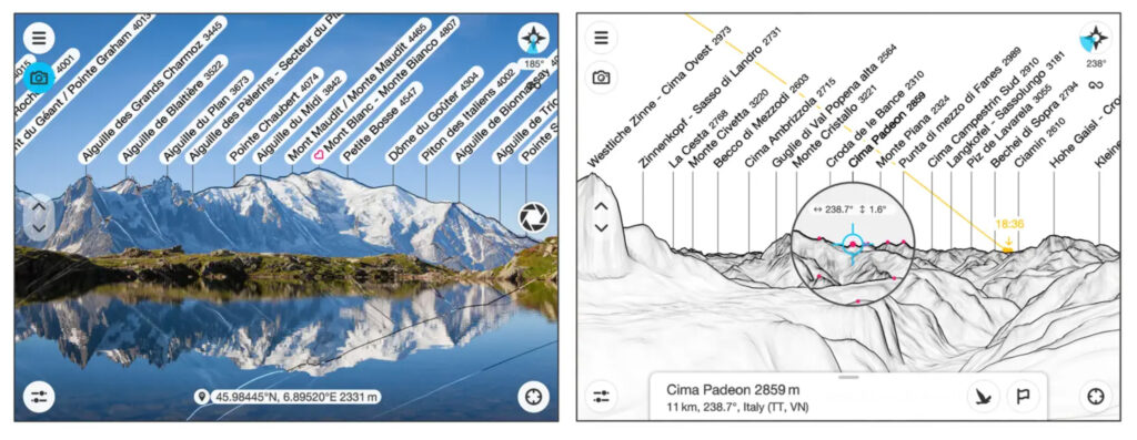
PeakFinder gives you the ability to identify all the mountains around you, see how tall they are, where they are in relation to others around them, and read more information about them.
The app comes with an elevation model built in, so you can use it offline. By using your GPS, it can overlay a detailed map on the camera image—much like Star Walk 2 does for stars.
You can also scroll upwards to elevate the image and see what’s over the horizon, and zoom in on any area for a closer look. It makes it easy to get a grasp on the region around you, and inform and inspire your exploration.
PeakFinder is available for $5 on both iOS and Android.
15. Rock Identifier: Identify rocks and learn about geology
To the uninitiated, rocks may at first sound a little boring, but anyone who’s walked through certain markets and shops and seen the variety of shapes and colours of crystals and stones will likely find their curiosity piqued.
Whether they’re used for mystical healing, engineering purposes, or simply as aesthetic decoration, people have relied on the minerals and formations found within the earth for centuries.
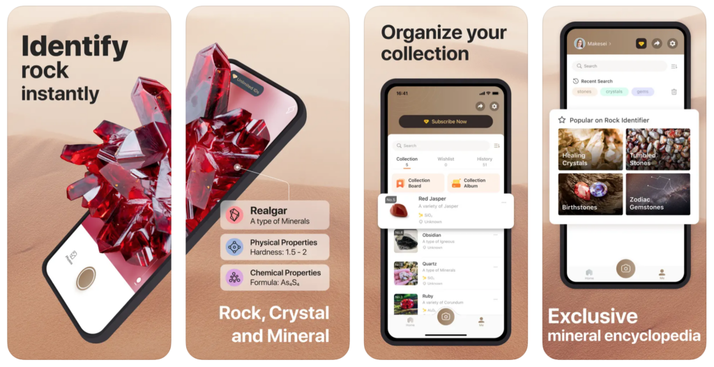
Want to know which ones and for what reasons? The Rock Identifier app can pick out over 6,000 rocks and minerals using your camera, and provide information on the different features and chemical qualities of it, its price, supposed healing properties, and the history of how it’s been used.
Interestingly, it can also act as a metal detector by picking up on magnetic fields, great for hunting along the beach. You can also save your rock collection in the app to keep track of those you have at home or are simply most interested in.
For both iOS and Android. There’s a 7-day free trial, and then yearly subscriptions for $30.
The Smartphone Is The Ultimate Tool For Citizen Scientists And Naturalists
Phones can often seem to be one of the obstacles to disconnecting, something that demands our attention and keeps us plugged into the digital world. But with a little conscious design and personalisation, your phone can take on quite the opposite character.
Use it correctly, and it becomes a tool that offers a general way of studying all nature has to offer. Point it at the stars, the earth, the life, and have it teach you what there is to know. Take into the wild, and have it show you around.
Imagine how difficult this all would have been to achieve in the past—lugging different equipment around, carting things back to be examined later. Now it all fits in your pocket, ready to recognize whatever nature has to offer.
The apps mentioned here give you the ability to learn about almost anything you come across when you’re out and about. As AI and technology improve, this companion naturalist should only grow in expertise.
- 10 Sustainable Travel Trends Driving The Future of Tourism - March 9, 2025
- 10 Tips To Sell Out Your Transformational Retreats In 2025 - February 20, 2025
- Build 10 Habits That Free Up Your Time With Mindful Coaching - February 11, 2025


